
Hidden Territory Realignment Intelligence
As of the November release, the territory realign process has been streamlined in a very exciting way! This is done through our new Hidden Territory Realign Intelligence. Check out how it works:
Previously, if a user was building his territories using postal codes, all postal code boundaries would be in play for the realign process, so the user had to be careful only to select which ones he wanted to realign. As of the November release, however, if a territory is hidden, then the postal codes it contains can be opted in or out of the realign processes
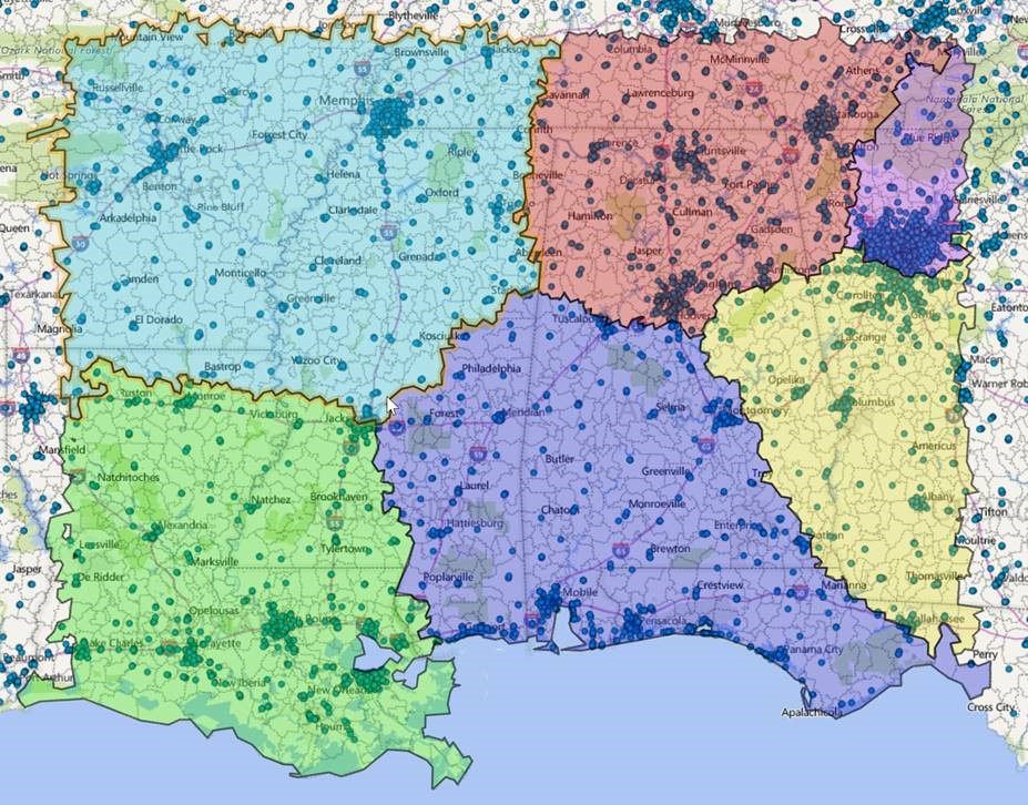
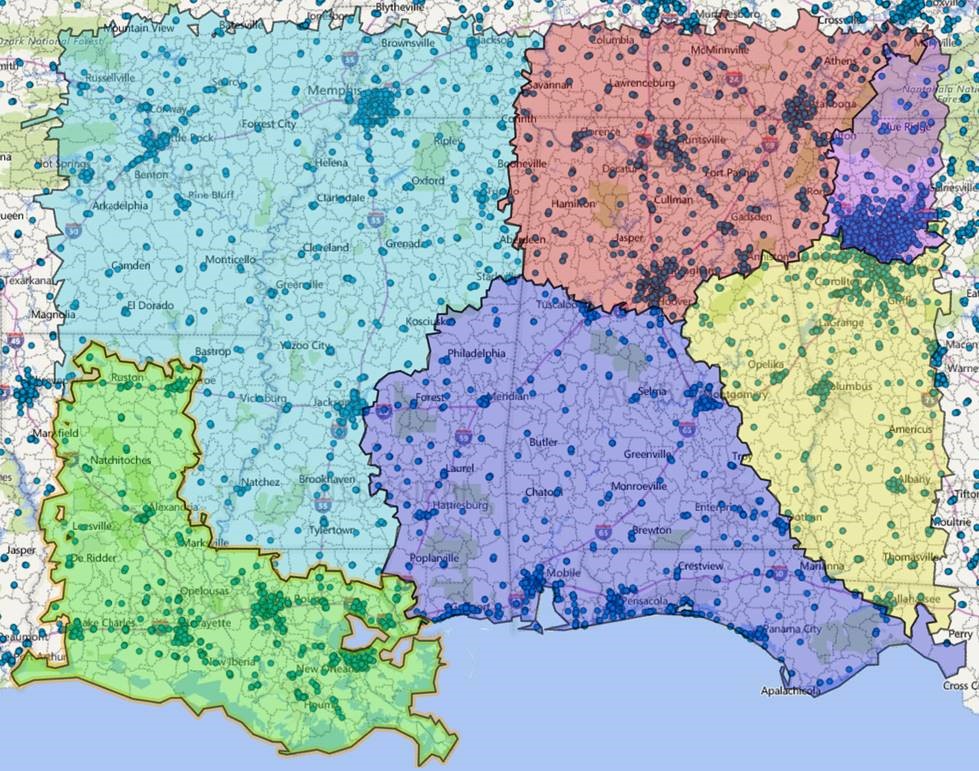
Say these were the territories that the user wished to realign:
If the user wished to move some postal codes from the lower southwest (green) territory to the upper northwest (light blue) territory, he can do so quickly and easily using the following steps:
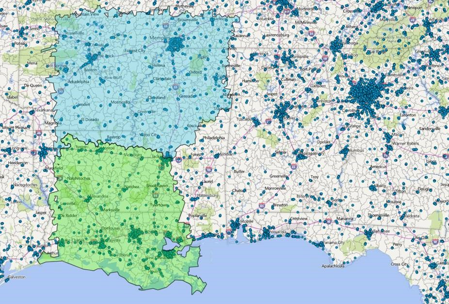
1. Turn off adjacent territories that are not involved in the realign:
2. Casually select the postal codes he wants to move (note how there would be overlap with the hidden territories).
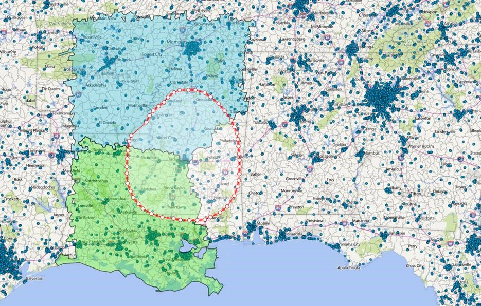
3. Query the postal codes
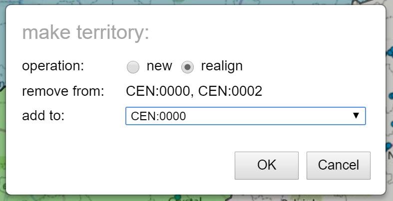
4. Select “Make Territory.” He will then be asked if he would like to use the postal codes from the hidden territories in the realignment:
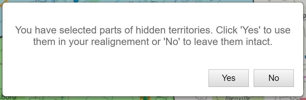
5. Click “No” to leave the postal codes intact in their hidden territories. Choosing “Yes” would cause them to be realigned even though they are hidden (as would have occured in previous versions of EasyTerritory). Then procede with the territory realignment as normal:
None of the hidden territories will be affected by the realignment:
Notice the realignment moved only those from the visible territories, leaving the previously hidden ones intact.
If you have any questions or would like to sign up for a trial, please contact us at sales@easyterritory.com
