EASYTERRITORY ANNOUNCES FEBRUARY 2016 RELEASE
The February 2016 release of EasyTerritory (v2.17.8) is now available! This release includes performance and security enhancements. If you’re ready to upgrade, please contact your EasyTerritory account manager today.
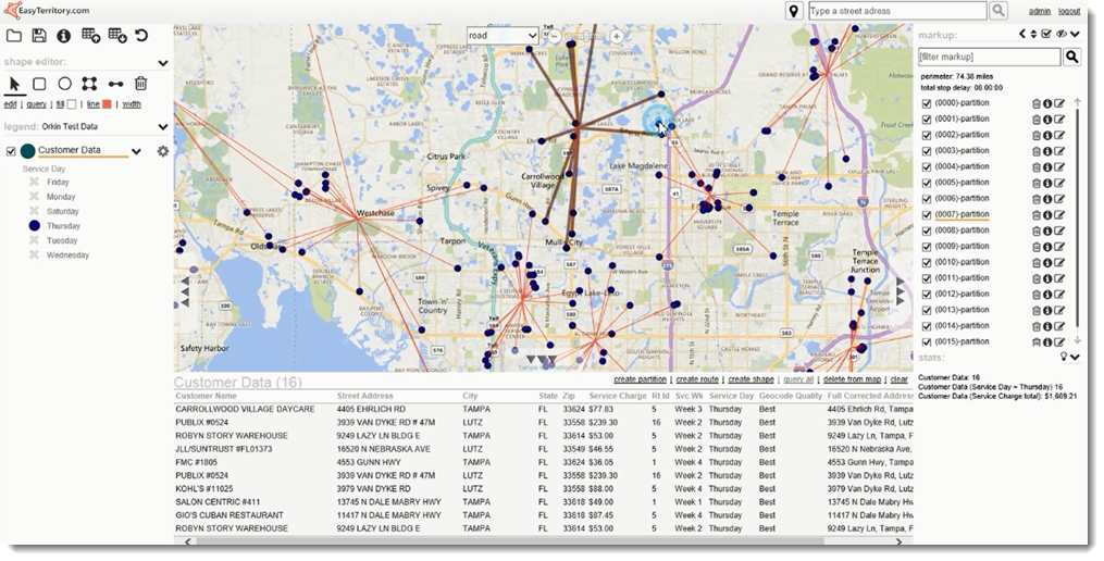
RELEASE NOTES
- Route partitioning* – divide point records up by total time (stop delay and drive time)
- Stop delays and leg times in turn-by-turn directions
- Stop markers displayed on route stops on the map
- Markup tags can be repositioned
- Support for unique identifier in geocode upload process
- Routing and partitioning now work with server-side layers
- Can send data-grid results directly to the markup-builder
- Added shape-stats by classification
- Can now do shape operations on projects with only uploaded/geocoded data
- Routing can be cancelled in mid-processing
- Several fixes and improvements
*Partitioning allows users to divide point datasets into one or more clusters of equal time based on stop delays at each stop and drive time between stops. Partitioning, or “rough-routing”, is used to break a large workload of service requests or sales visits into groups for each technician or salesperson. Clusters created by the partitioning step can be fine-routed to get detail driving times and directions.