
Beta
MCP Server
MCP Server (beta) takes territory planning into the agentic era — putting humans above the loop to orchestrate and supervise instead of endlessly stuck behind screens. Built on the same tools and algorithms used in Territory Designer, it lets you connect your favorite AI agent (Claude Desktop, OpenClaw, or any MCP-compatible host) to build, balance, analyze, route, and share territory solutions. Whether it’s a one-off scenario using the MCP Map or a headless repeatable workflow, your agent can operationalize and handle the heavy lifting — you make the strategic calls.
Territory intelligence, on autopilot
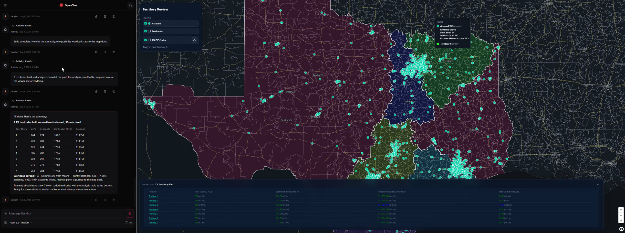
The MCP Server exposes 46 territory planning tools to any MCP-compatible AI. Ingest and geocode account data from any source. Build balanced territories, isochrones, analyze workload equity, plan optimized routes, schedule recurring visits, and share executive-ready insights — all through natural conversation.
What it can do
MCP Server is built for sales operations leaders and territory planners running agentic workflows. Built on the same tools and algorithms used in Territory Designer, you and your AI agent decide the approach — hands-on using the integrated map or completely automated — all of the tools work with or without a visual interface. Your agent pulls data from your file storage, CRM or ERP; uses MCP to perform scheduling, routing or territory realignment — delivering consistent repeatable outcomes.
Intelligent Territory Building
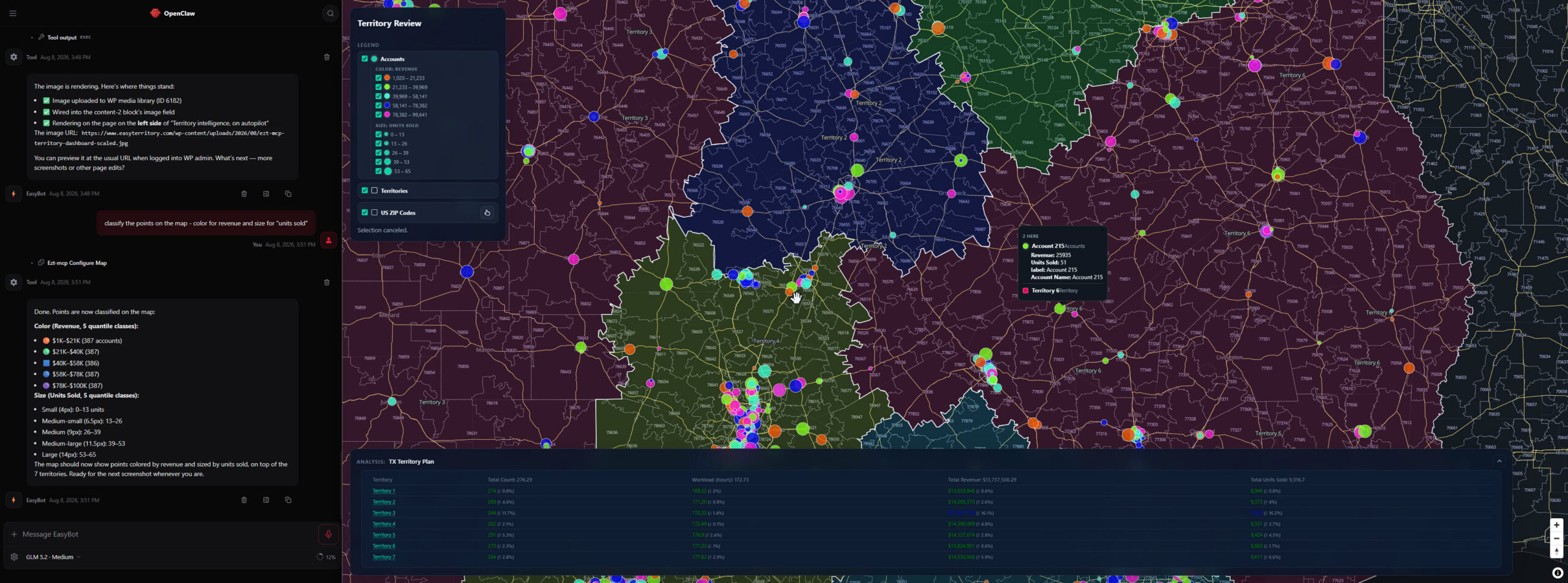
Build balanced territories from scratch or from existing alignment files. Define your goals — territory count, workload targets, balance metrics — and let the agent handle the rest. Convert account-based alignments to territory regions and vice versa. Create franchise zones from a starting point and nearby locations. Analyze territory balance, workload distribution, and coverage gaps. Review results on an interactive map and share read-only views with stakeholders.
Natural Language Territory Management
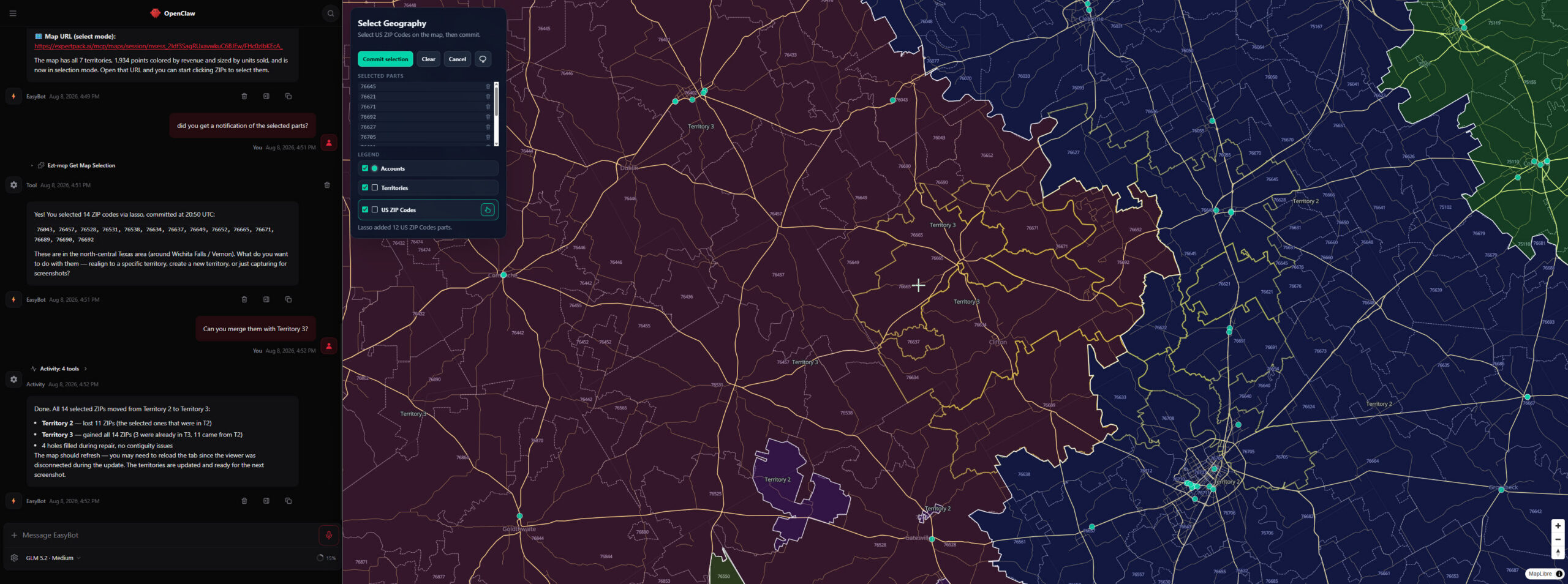
Realign Postal Codes between territories, split or merge regions, and rebalance after data changes — all through conversation with your agent, or using visual selection directly on the map. Multiple territory alignment scenarios can be visualized and compared side by side.
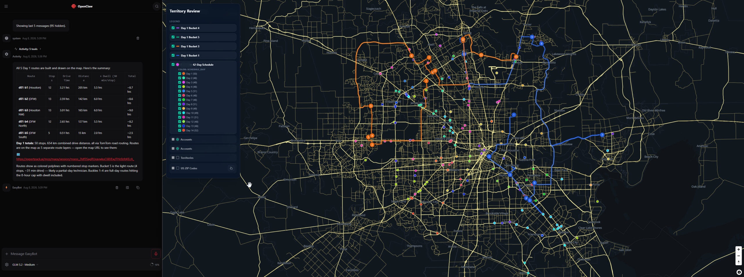
Optimized Routing & Scheduling
Calculate optimized, multi-stop routes with stop-priority banding and circuit, tour, or open-tour formats. Build recurring visit schedules that cluster accounts into daily work buckets by cadence and capacity — minimizing drive time across the entire horizon.
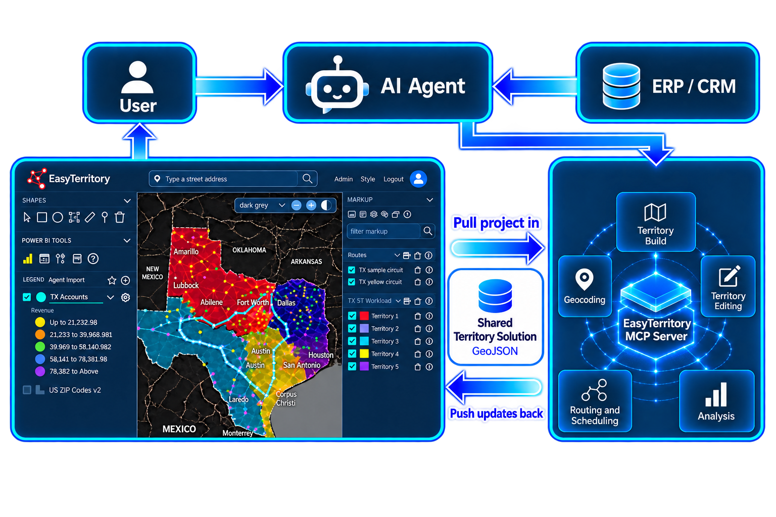
Roundtrip with Territory Designer
MCP Server works roundtrip with Territory Designer. Pull a project into your agent, run fully automated territory management workflows, then push updates back as GeoJSON for review. Planners stay in control — agents do the heavy lifting, and every change can be approved in Designer before it becomes the system of record.
Why EasyTerritory MCP
- Hosted by EasyTerritory — not self-hosted. Customers connect their agent and go.
- You and your agent own your data — EZT MCP never retains customer information, lowering risk of a third-party being your system of record for critical internal data.
- Standard GeoJSON in and out — no proprietary formats. Push your alignments to Territory Designer for hands-on refinement when you need it.
- ExpertPack knowledge layer — encodes a decade of territory design expertise that is not found in foundation AI models.
- Built on the latest MCP V2 specification (2026-07-28).
- Full documentation — setup guides, tool reference, and examples to get you started.