
Territory Designer
The Territory Designer delivers a powerful, intuitive web application for managing and optimizing sales and service territories. Whether you’re fine-tuning existing territories or building new ones from scratch, EasyTerritory makes complex spatial data management fast, accurate, and effortless.
Design territories like a Pro
Designed for speed and flexibility, the platform allows users to quickly upload ZIP Code-to-territory alignments, import account and lead data directly from Excel or Microsoft Dynamics 365, and visualize results instantly on an interactive map. With drag-and-drop simplicity, users can realign territories in seconds—balancing workloads, optimizing coverage, and ensuring efficient sales operations.
Who should use it?
The Designer tool empowers teams to build, balance, and optimize territories with confidence. It’s built for sales operations leaders, territory planners, capacity planners, and Power BI report developers who need accurate, trusted territory and workload data to drive insight and decision-making. Routing and operations teams also rely on Designer for bulk, optimized routing scenarios—such as multi-stop deliveries—ensuring efficient execution at scale.
Flexible Data Upload
Upload account, territory, and reference data using Excel, Dynamics 365, Power Platform, SQL Azure, and more. Standardized imports ensure clean, reliable data for downstream planning.
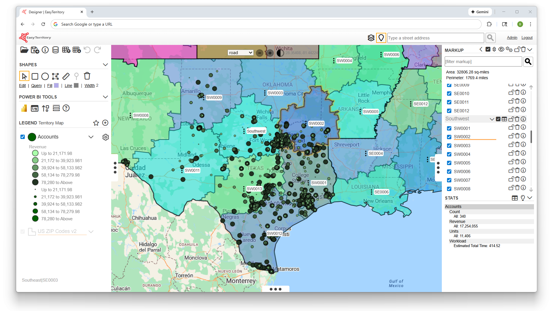
Geography Based-Territory Design
Create and manage territory boundaries using Postal Codes, Counties, States, Countries and more. Design territories that balance coverage, workload, and geographic logic.
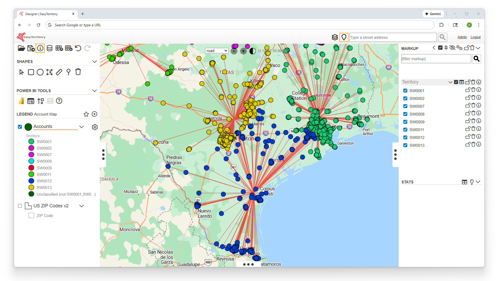
Account-Based Territory Design
Build territories directly around accounts instead of geography alone. Support strategic account models, named accounts, and hybrid coverage strategies.
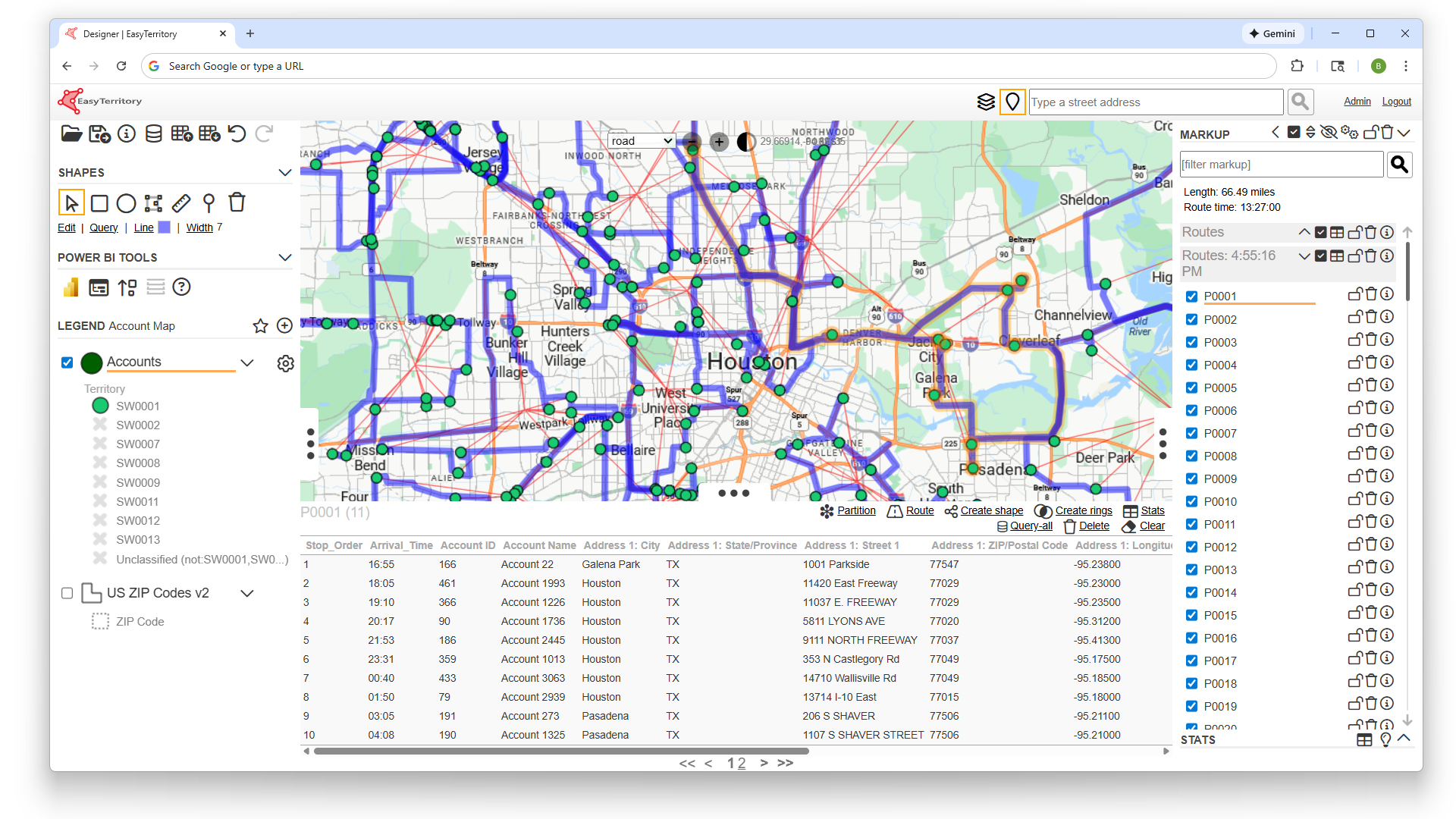
Bulk Optimized Routing
Calculate optimized routes at scale across territories and accounts. Improve rep efficiency and reduce travel time without manual route planning.
Built-In Capacity Planning
Model workloads and capacity by territory, rep, or account volume. Ensure territories are realistic, equitable, and achievable before deployment.
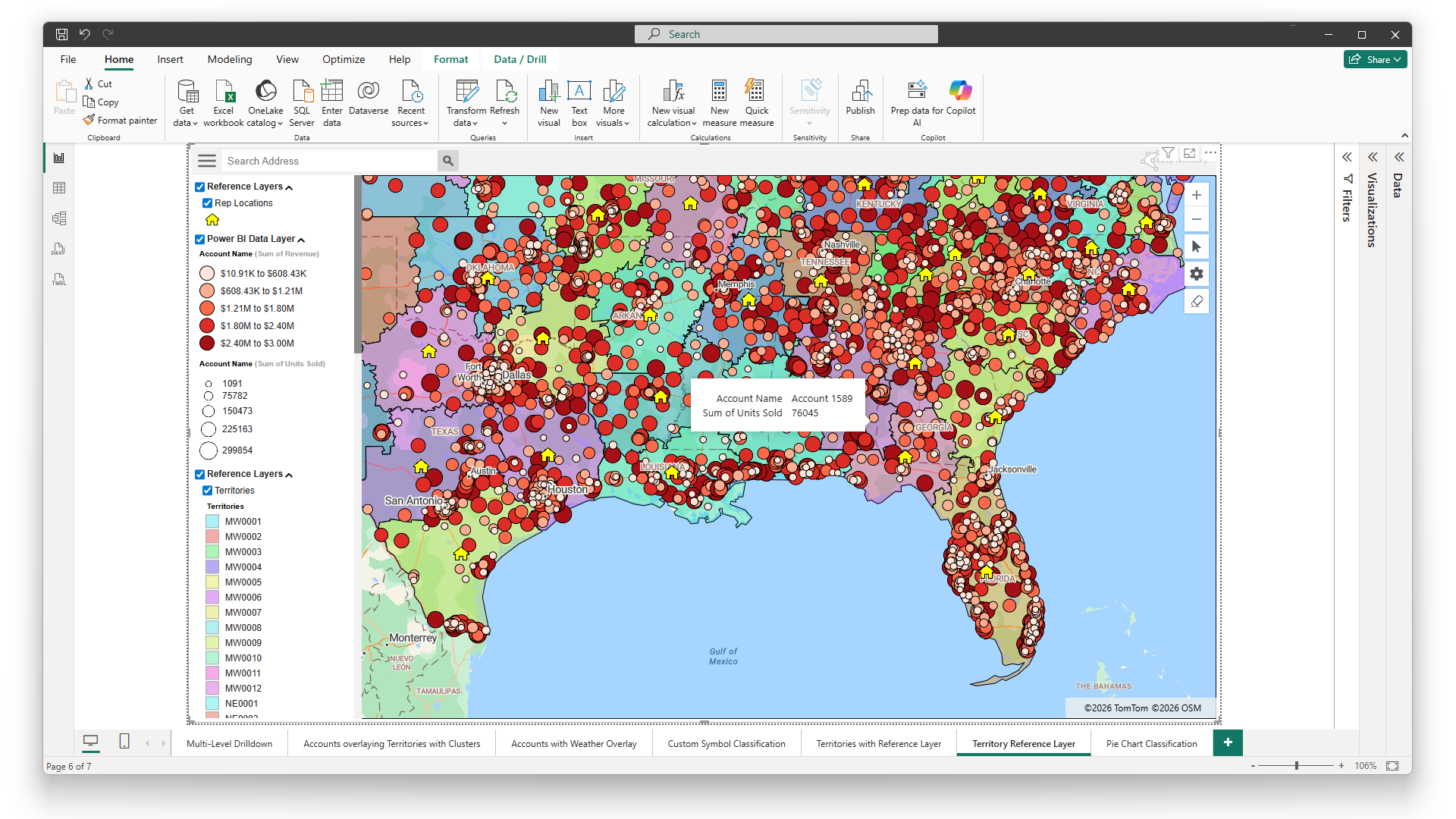
Native Power BI Integration
Publish territory and routing data directly to Power BI for analysis and visualization. Turn territory design decisions into actionable insights and executive-ready dashboards.