
INTRODUCING SUPPORT FOR TRAVEL-TIME RINGS
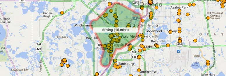
The EasyTerritory development team has added travel-time ring support to the core product. Travel-time rings are polygons describing a specified travel-distance from a given point. The types of travel supported are ‘driving’, ‘transit’ (where available) and ‘walking.’ For site planning and certain marketing efforts it is more useful to select information based on a travel distance rather than using an as-the-crow-flies distance. For more information on how travel-rings are created within EasyTerritory, please check out this video:
