Blog
Events & Webinars
Contact Us
CALL US
+1 (850) 629-4274
Products
Enterprise Edition
EasyTerritory for Power BI
EasyTerritory for Dynamics 365 for Sales
EasyTerritory for Dynamics 365 for Field Service
EasyTerritory for Dynamics 365 for Marketing
EasyTerritory for SQL Azure
EasyTerritory for Azure IoT
Standard Edition
EasyTerritory for Excel
Power Platform Components
Power BI Territory Visual (Live Demo)
EasyMap Power App (PCF Control)
EasyTerritory Locator
Pricing
Successes
Docs
End User
Administrator
Developer
Dynamics 365 Integration
Power BI Integration
Postal Code Data
Free Trial
Menu
Menu
Products & Services
EasyTerritory for Dynamics 365 for Sales
EasyTerritory for Dynamics 365 for Field Service
EasyTerritory for Dynamics 365 for Marketing
EasyTerritory for SQL Azure
EasyTerritory for Azure IoT
EasyTerritory for Excel
Custom Power BI Reports
Maps for Power Apps
Store & Rep Locator Maps
Pricing
Client Successes
Documentation
End User
Administrator
Developer
Free Trial
Blog
Team
Events
Contact Us
EasyTerritory End User Documentation
End User
Administrator
Developer
Dynamics 365 Integration
Power BI Integration
Overview
Application Overview
Keyboard Shortcuts
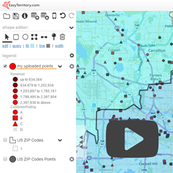
Uploading Business Data
Upload Address Data to Create Points
Editing Geocoded (Point) Data
Join Tabular Data
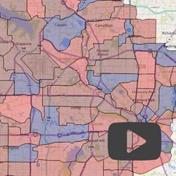
Territory Management
Uploading Territory Data
Realign Territories
Automatic Territory Builder
Managed Project Support
Business Intelligence
Territory Statistics
Sales and Service Routing and Planning
Creating Optimized Driving Routes
Partitioning Services
Workload Partitioning
Scheduling
Capacity Planning
Create Rings
Advanced Partitioning
Cluster and Distribute
Mobile Mapping
Mobile Sales Productivity
Application Overview
Layer legend: understanding client and server layers.
Editing client side layers and configuring record columns.
Working with the data grid.
Markup panel and shape stats.
Using EasyTerritory icons: rolodex, save, and identify.
Shape editor panel: using selection tool, drawing tools, and point drop.
Version 2.72.3+
Keyboard Shortcuts
Undo/ redo operation: CTRL + Z/ Shift + Z
Add record to data grid: CTRL + Click
Deselect record in data grid: CTRL + SHIFT + Click
Reorder records in data gird: CTRL Up/Down Arrow
Add/Remove record to partion: CTRL + Click/ CTRL + Shift + Click
View components in territory: CTRL + Click on territory.
Zoom into a specific area: CTL + CLick and Drag
All Versions
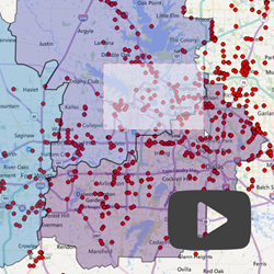
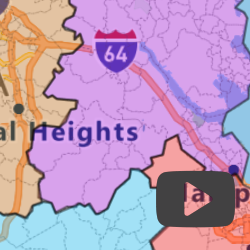
Uploading Territory Data
Format and prepare territory data in .csv for upload.
Add necessary map layers that corresponds with .csv data.
Using cleanup options to your .csv data before uploading.
Markup builder and working with markup panel.
Version 2.0.11+
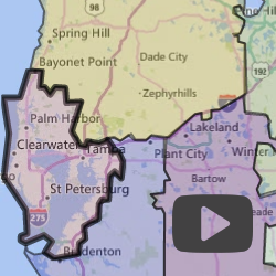
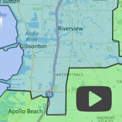
Realign Territories
Add new boundaries to territory.
Using shape stats to help make decisions about realigning territories.
Realign an existing territory with an adjacent territory.
Editing territory name and color.
Realign an exisitng into a new territory.
Version 2.26.1+
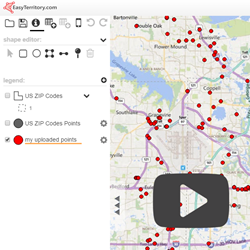
Upload Data to Create Points
Formating and preparing data in .csv for upload.
Upload .csv into EasyTerritory to Geocode.
Configuring and adding flags to the record columns.
Record callout.
Filter and classify records.
Version 2.0.11+
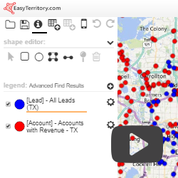
Integrating with Microsoft Dynamics 365
Accomplished through managed solution.
Moving data from Dynamics into EasyTerritory via Advanced Find View.
Save territory alignment from EasyTerritory back to Dynamics.
Version 2.0.11+
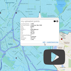
Editing Geocoded Records
Record editing prerequisites.
Identify record to edit
Relocate record by entering a new street address
Relocate feature by clicking on the map
Edit record’s attributes
Add a new record and delete record.
Version 2.55.6+
Join Tabular Data
Join data with a specific map layer.
Upload data and choose from upload activity options.
Configure columns in your new map layer.
Classify data and visual presentation of data on map.
Version 2.29.8+
Managed Project Support
Overview of Managed Project Support.
Assigning manager coverage area
Setting up managing and managed projects
Limiting Manager query results to avoid overlaps or gaps in coverage
More information
Version 3.12+
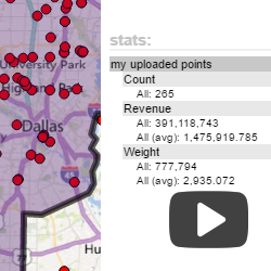
Show Statistics on Territories
Viewing basic and detailed statistics from a territory.
Viewing statistics across all territories
Export statistic data to excel.
Version 2.26.1+
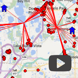
Partitioning Services
Creating partition and working with settings dialogue.
Partioning into clusters based on drive time and delay.
Manually adjust points in cluster.
Create route from cluster.
Version 2.17.8+
Advanced Partitioning
Querying records and reordering specific records in data grid.
Create partitions based on specific records.
Configuring and editing partitions.
Viewing shape stats of partitions.
Route partitions.
Version 2.55.6+
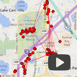
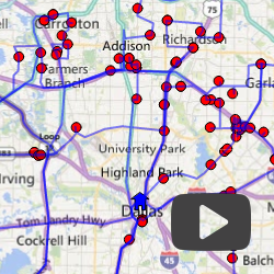
Routing
Selecting records to include in your route.
Order of stops on your route.
Configure settings in create route diologue.
Review route and print turn by turn directions.
Create routes with serveral stops using the polygon tool.
Create routes using records from two different layers.
View route and export.
All Versions
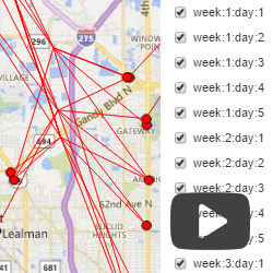
Scheduling
Configuring columns to allow scheduling feature.
Create partion by using schedule tool.
Displaying scheduled visit partitions.
Find route.
Version 2.29.8+
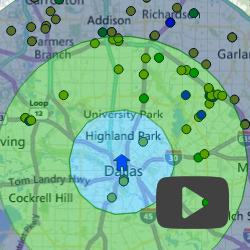
Create Rings
Create rings from the callout.
Configure straight-line distance or travel time rings.
Configure mulitiple rings.
Clip interior portion of each ring.
Set rings as a markup group.
Version 2.77.7+
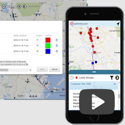
Mobile Sales Productivity
Add a route to the data grid.view.
Add route to mobileview.
View mobile view.
Edit mobile view.
Link to share mobile view via e-mail.
Version 2.58.2+
Scroll to top