
How EasyTerritory Enhances a Dynamics 365 for Field Service Implementation
We are often asked how EasyTerritory fits into a Dynamics 365 for Field Service implementation, so we put together this whitepaper to explain. While the D365 for Field Service solution has several mapping features, the real benefit of EasyTerritory is on the front end, defining and managing your service areas (or, as we like to call them, territories)! The following whitepaper contains a high-level description of how EasyTerritory supports the building, synchronizing, and setting of territories in D365.
Defining Territories
EasyTerritory Enterprise provides up-to-date postal code data for many countries, including the US, Canada, and Mexico. Since many organizations align their service tech territories by geographies (like ZIP Codes), these are important datasets. Using EasyTerritory, an organization can import an existing ZIP Code to Territory alignment and then use EasyTerritory to move postal codes from one territory to another. Additionally, territories can be automatically rebuilt and optimized based on your service call frequency or workload data by overlaying your business data from D365.
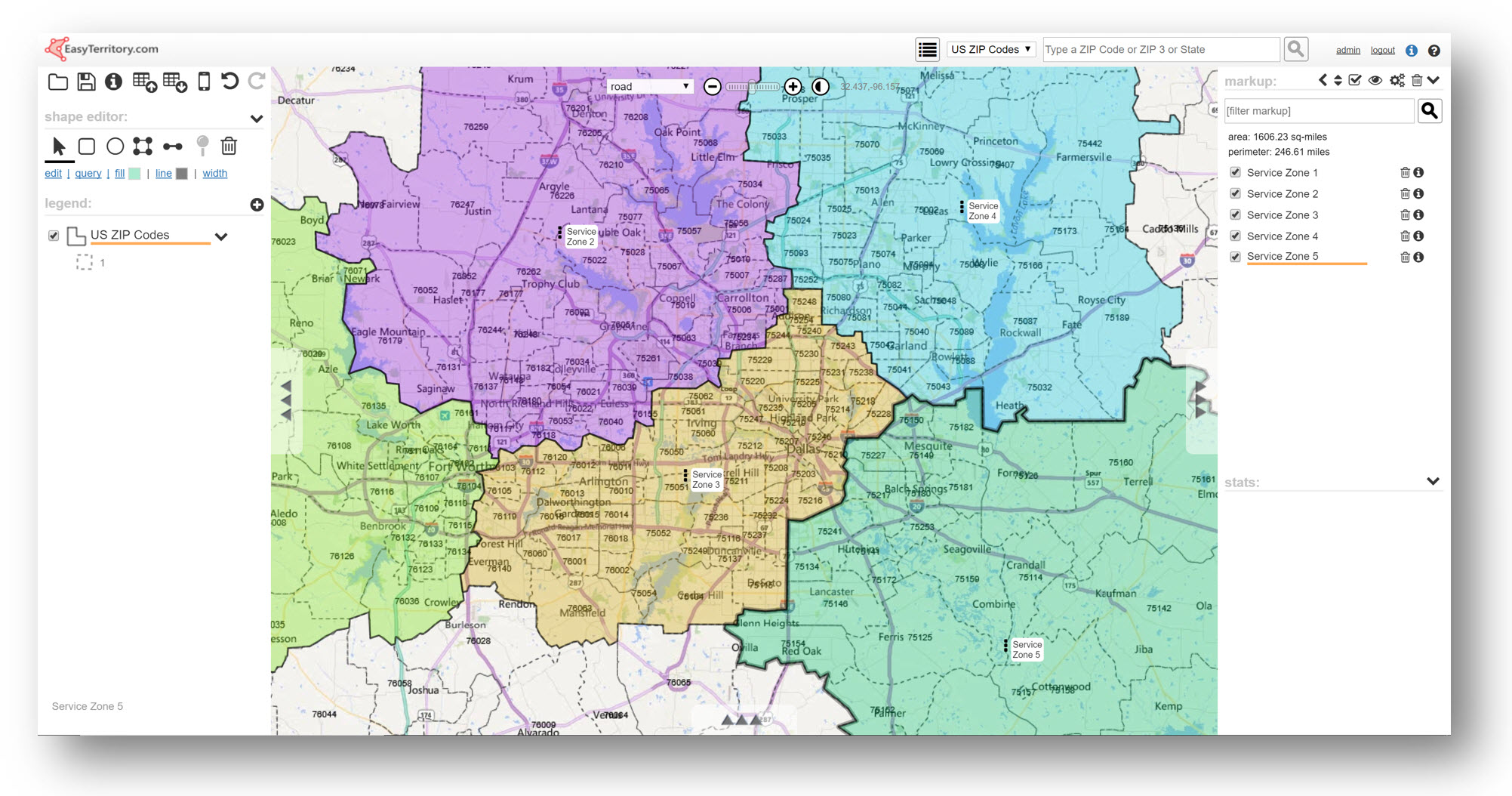
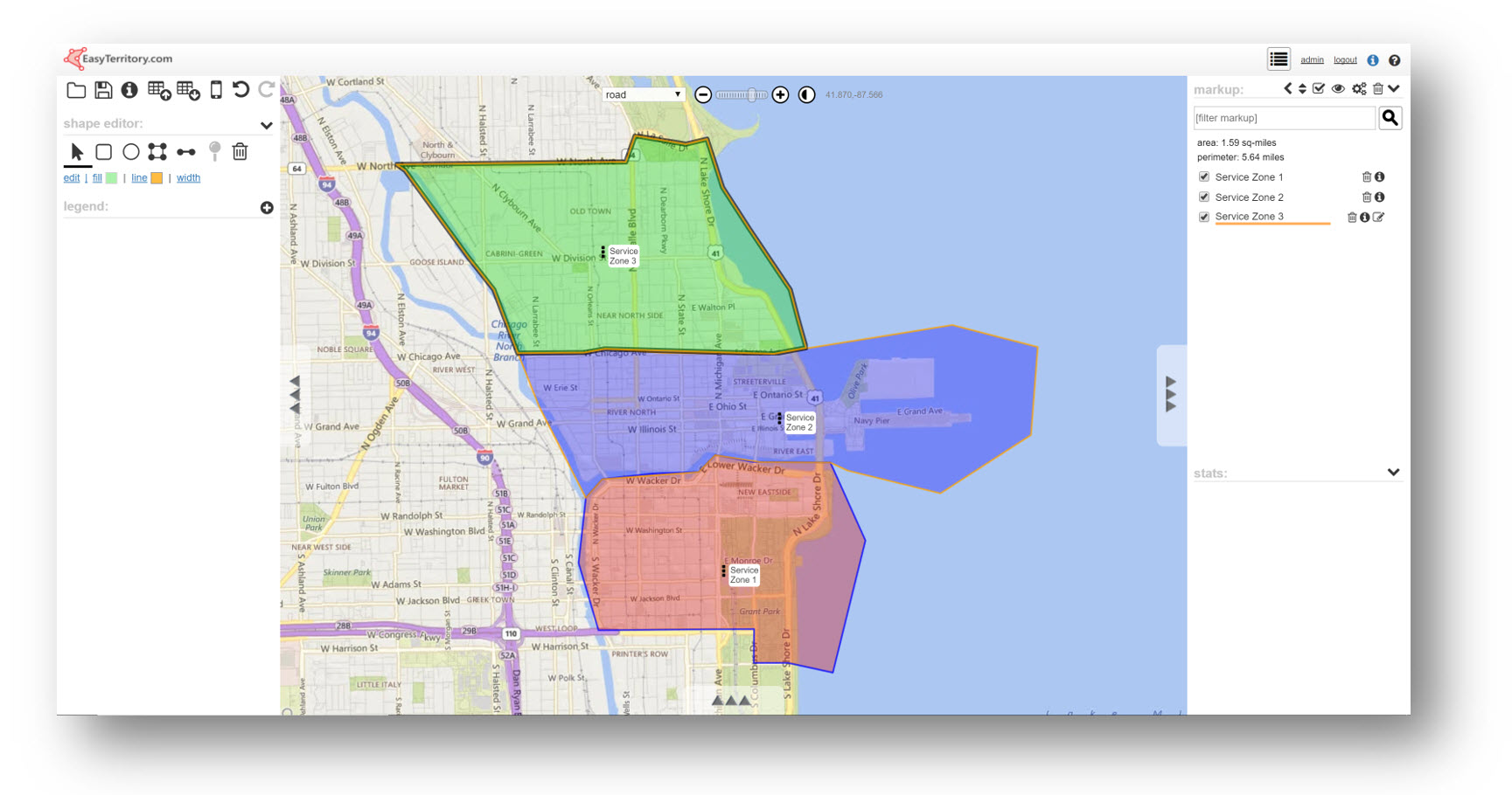
In addition to aligning by geography, EasyTerritory supports the ability to manually draw territory shapes on the map. For example, if territories follow roads or rivers, they can be manually drawn using the EasyTerritory drawing tools. The drawing tools in EasyTerritory allow for snapping to adjacent territories.
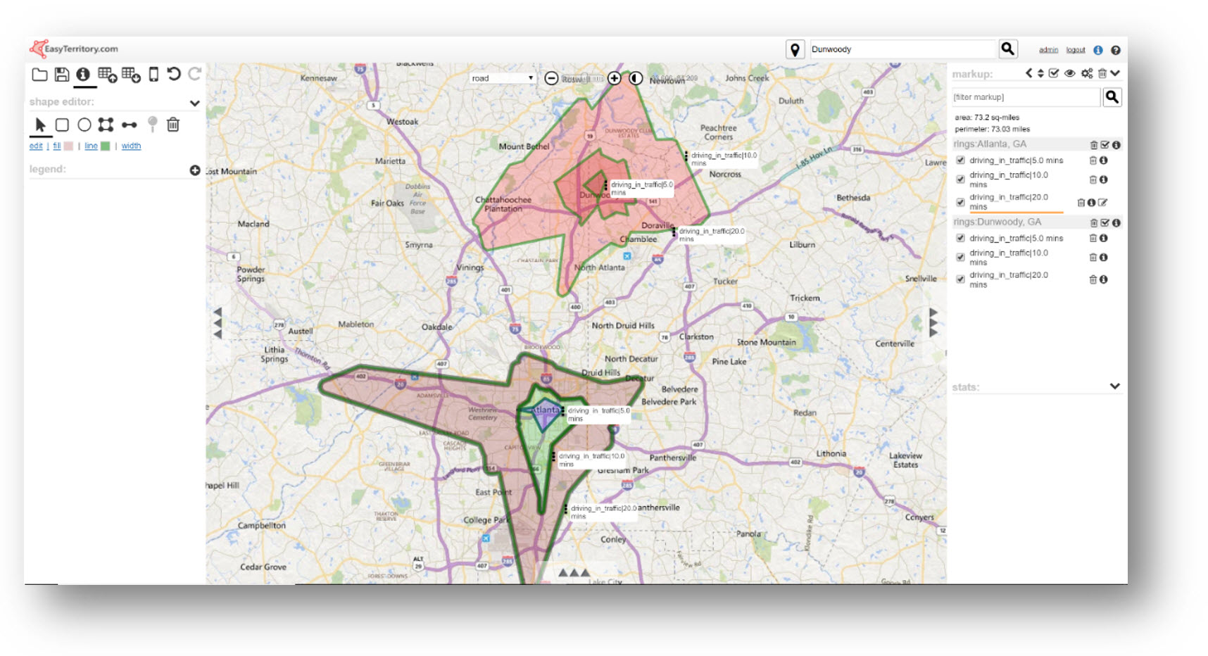
Another popular way to define service zones is by travel time ring. EasyTerritory supports the building of territories by travel-time or distance. Travel rings can be calculated by an address manually plotted on the map or from an overlay from your CRM data, such as warehouse location data.
Populate Dynamics 365 with Territories
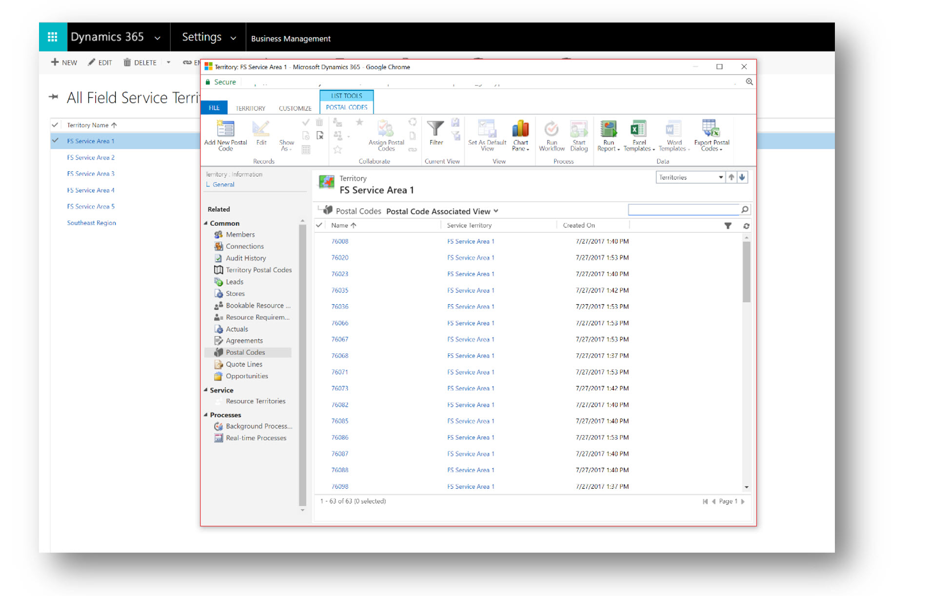
Once territories have been built in EasyTerritory, the next step is to integrate EasyTerritory with Dynamics 365 to push territories to the Territory Entity (or a target custom entity in D365). At this point, the EasyTerritory Managed Solution can be downloaded and installed from Microsoft AppSource.
EasyTerritory Enterprise has a configuration for writing territories back to Dynamics 365 with the push of a button. This feature supports writing new territory records to D365 as well as updating target (related) records in a second entity (e.g. Account, Work Order, or Postal Codes) if a territory alignment changes.
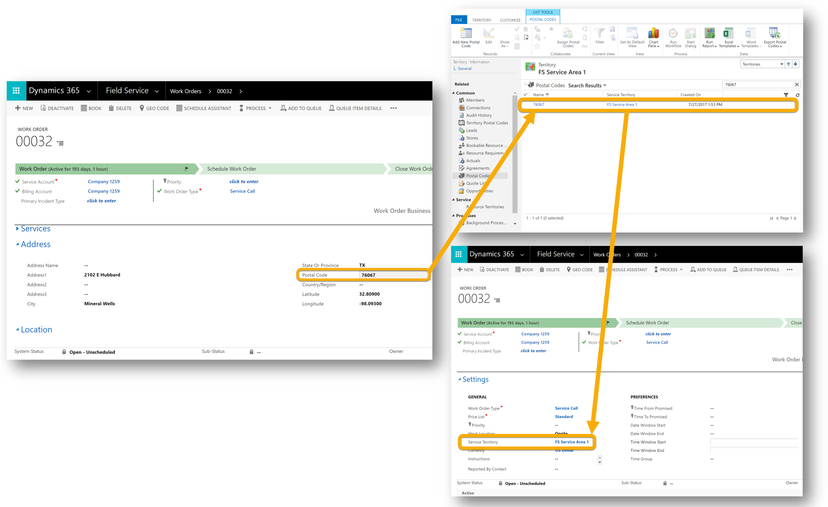
In this example, EasyTerritory has written a territory to D365 call ‘FS Service Area 1’ and updated a second entity, Postal Codes, setting the relation between Territory and Postal Code.
Setting a Territory on a Record (e.g. Account or Work Order)
At this point, there are two options for setting a related Territory on an entity record for Account or Work Order.
Option 1 – By Geography Lookup
The EasyTerritory Managed Solution provides FREE US ZIP Code data and enables ease of management of the ZIP Code to Territory alignment using a map and may be the preferred approach for an organization aligning to postal codes. With this approach, a ZIP Code (postal code) list will be maintained in the Postal Code entity that ships with D365 FS. Using this list, we can perform auto-assignment to Work Orders or new Accounts as they are created in the system. The lookup to Postal Code entity is done through a regular workflow.
Option 2 – By Spatial Lookup
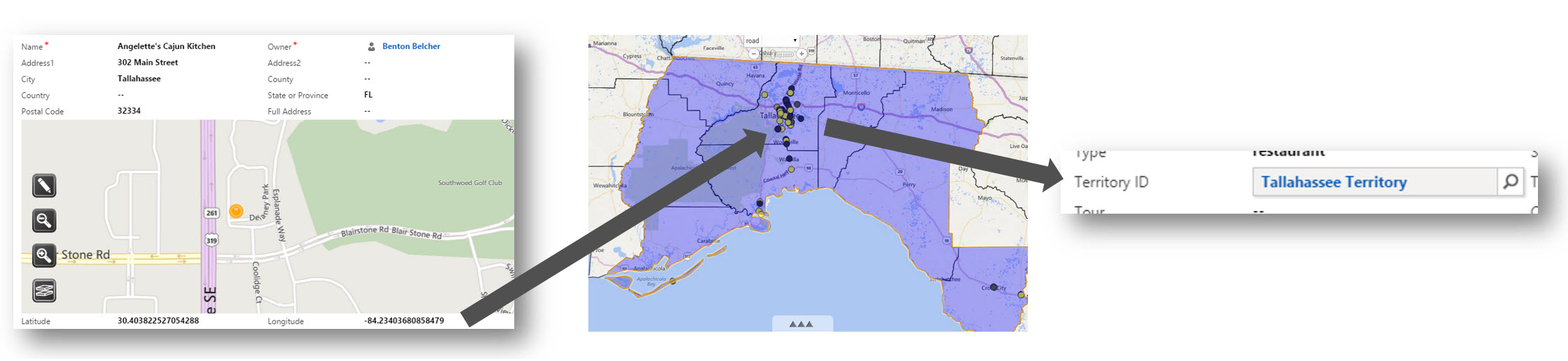
With the ‘Spatial Lookup’ approach, the EasyTerritory Location Lookup workflow plugin for D365 can be used to “lookup” the territory of an Account or Work Order based on the records full address. This approach is very useful if territories are not defined by postal codes, as would be the case with territory boundaries which have been manually drawn or with those defined by a travel ring (drive or travel time). The Location Lookup plugin call passes the latitude and longitude of the address to the EasyTerritory REST API and the spatially intersected territory is returned for setting the territory on the record.
Filtering on Territory in the Resource Scheduler
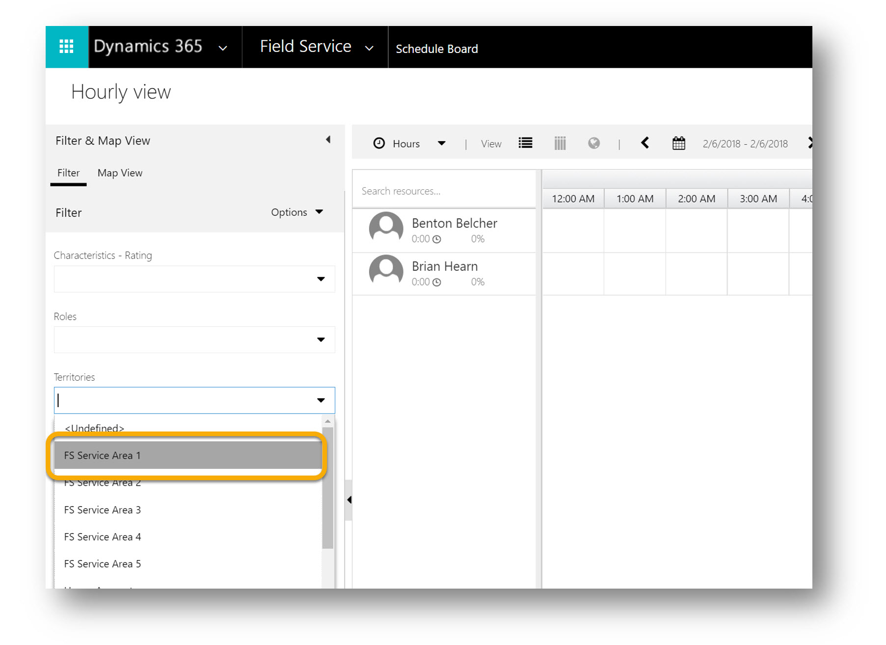
Finally, with the territory relationship set on the record, the Territories filter can be used in the FS Resource Scheduler to quickly filter Resources to a smaller subset for ease of scheduling.
Summary
With EasyTerritory, the large task of managing service areas (territories) for use with Dynamics 365 is simplified by using an interactive map for managing territory boundaries, leveraging plugins for writing territory changes back to D365, and using utilities/workflows to automatically perform territory assignments.
